Friday, January 26, 2007

More from Florida


I took a picture on my walk today to give you an idea of the surroundings here in John Prince County Park. This picture is taken from the road looking across a slough. (At least we would call it a slough in Missouri.) If you look carefully, you can see a Great Egret wading in the water, fishing (or maybe frogging?). To the left up, on the land is a Great Blue Heron, who seems to be just hanging around. There are at least three kinds of herons here. In addition to the Great Blue, there are Tricolored Herons and Green Herons.

Last weekend I went up to Inverness, FL to visit family members. Inverness is perhaps 150 to 200 miles north of here. It is amazing how the climate changes here in Florida by going such a small distance north. It was, at least ten degrees cooler, cooler enough so that long pants rather than shorts were called for.

Whereas the dominant feature here in the Fort Worth area, is either ocean or wetlands, Inverness is dominated by low rolling hill with intermittent areas of wetland. There is a lot of calcium rock there, remains, I suppose from the time when Florida was covered by a shallow sea. There are considerable phosphate deposits in northern Florida, and these are the result of the remains of small organisms, diatom-like, I suppose from when the area was covered by a shallow sea.

When one thinks of Florida agriculture, one thinks of oranges. Over the years the orange growing has moved south because of occasional freezing weather which can kill orange trees. I wonder what effect global warming will have on the location of orange groves in the future. Tomatoes and strawberries are wonderful Florida products and are just coming into the stores now. In this area there is a significant immigrant population, which I am told is involved in vegetable farming. Guatemalans are particularly prominent. On Sundays, one sees teams of Guatemalans playing soccer. Family picnics and get-togethers in the park are a common and pleasant sight.

Wednesday, January 17, 2007

Pictures Discussed Below, Part II


Posted by Picasa

Pictures Discussed Below, Part I


Posted by Picasa

Pictures of South Floridian Wildlife

Madeline and I took a short walk through the park, near our RV, the other day. Here are some pictures of the various critters we saw.

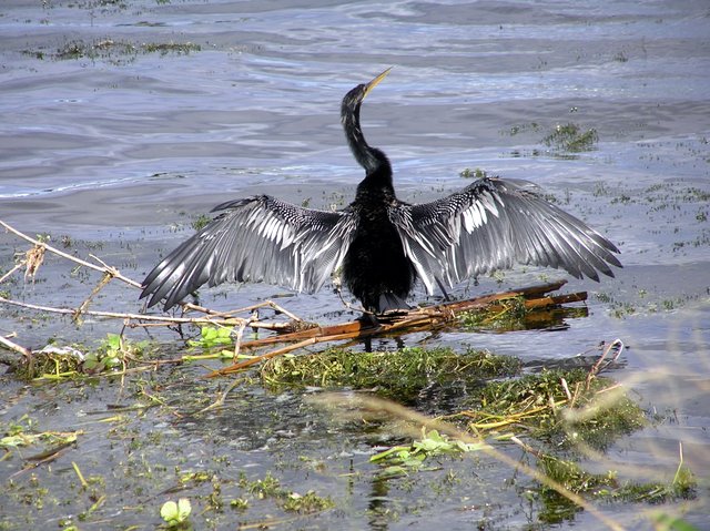
The first picture in Part I, (the second set of pictures) is of an Anhinga. The feathers of this bird are not waterproof, so the bird swims with just it's neck out of water, then dives looking for fish and resurfaces about 30 feet further on. Since it's feathers become soaked with water, when it gets through swimming, it comes out on the bank or sits on a branch, spreading it's wings to get dry.

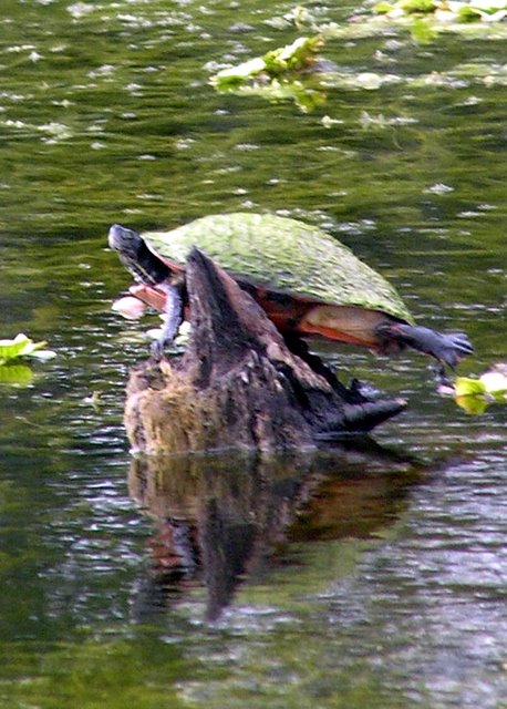
The next picture is of a turtle sunning itself on a log. As you can see it is about to jump.

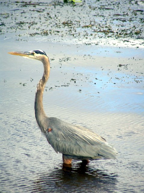
I thought the bird in the next picture was a Great Egret. But the picture shows me more than I could see from a distance, and now it looks a little like some type of crane. I need to work on this.

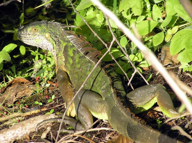
There is an Iquana in the next picture. Although this is a domesticated animal gone wild, there are quite a few of them here. The people in Boca Raton, a city near here, want a program to irradicate them, but I am not sure what damage they do, other than eat a few leaves. Maybe this is Florida' version of the white-tail-deer, a nuisance in more nothern cities.

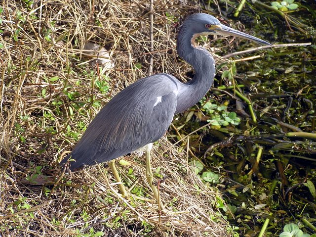
The first Picture in Part II, the first of the top three pictures, is a Tricolored Heron.

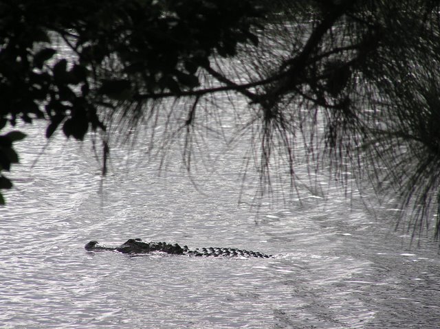
As, we were walking along , I wanted to show Madeline an Aligator, that I have seen here from time to time. Well, I almost walked on it as it was sunning itself on the bank on a grassy spot. It was startled (and startled me) and jumped (the aligator, I mean) into the water with a big splash. Madeline got a nice picture of it swimming in the water.

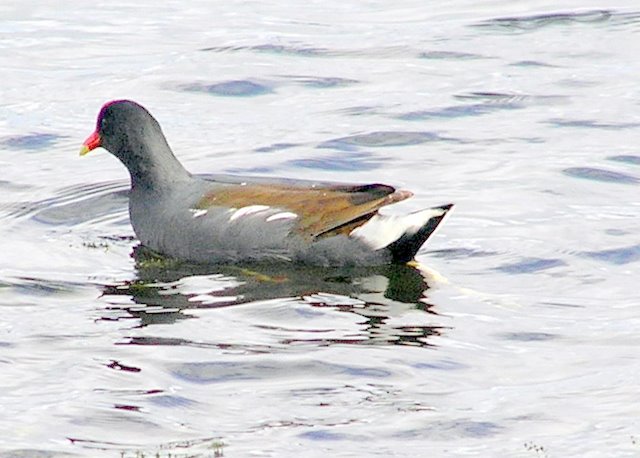
Finally there is a not-very-good picture of a Common Moorhen. There are quite a few of these in the water here. They have a bright red bill and a bright red face. They seem to be diving a lot. I think they are mostly vegetarians, so i suppose they are eating submerged waterweeds.

Friday, January 05, 2007

Florida and the Birds of Florida

Just before Thanksgiving, we moved to Lake Worth in Southern Florida. Lake Worth is on the Atlantic side of Florida, just south of West Palm Beach, and north of Fort Lauderdale. We spent Thanksgiving with our son, Hap and his family. Shortly after that we took a short trip north to Inverness, Florida and visited my niece and my sister.
We have been quite busy seeing our family!

Our daughter Diana flew out from Las Vegas for a short visit; last week I flew to Virginia and visited by son, Tom and his family. Daughter Debbie is coming to visit us in February and perhaps her husband Stu will also accompany her. Son Tom may fly down to see us at the same time.

Our new RV makes it much easier to have company. There are two sofa beds, and they are comfortable. (In our former RV, the sofa bed was “unsleepable”, and we usually set up an air mattress on the floor, with a sleeping bag.) Also, as you might guess, with the greater length (40 feet vs. 37 feet), and more slide-outs (four vs. one in the former coach) we have a lot more room --- well, for those of you who live in a house, you might not think it is a lot of room, but we find it spacious – in fact the two of us seem to rattle around in here.

It is always nice to get to southern Florida when winter comes. The weather has been pretty nice; although there were a couple of rainy spells, but usually it has been warm and sunny most of each day. The weather in Southern Florida differs from that in the north. It is warmer, and probably a little wetter.

We are staying in a county park, John Prince Park. This park is quite large, and surrounds about two-thirds of Lake Osborne. Only a small part of the park is devoted for camping – mostly RV, but room for a limited amount of tents. There is a bicycle/walking trail around the lake, and if one wished, one could take a ten mile walk or bike ride. Since I lost my sense of balance, I no longer bike, but I do walk some. There are several species of palm trees in the park, as well as banyan trees and some type of pine trees. The fishing is pretty good, but I have not tried it this year. There are bass, catfish and tilapia. However, when I did fish, I only succeeded in catching bass on artificial lures. When I tried to use worms, I caught turtles, and believe me, that is not much fun!

There are lots of water fowl here. There is a small family of wood storks (3-4 birds). They are impressive, both because of their size, but also they are quite ugly, with bald red heads. From time to time there are pelicans. These are huge creatures, soaring over the lake looking for fish. When they see one, they go dive head first in a free fall of perhaps fifty feet. You would think they would hurt themselves, but they don’t seem to.

When daughter Diana was here she gave me a small guide to southern Florida water birds. While on a one hour walk yesterday I saw the following birds:

Great Egret
Glossy Ibis
Little Blue Heron
White Ibis
Anhinga
Common Moorhen
American Coot
Limpkin

My New Year’s resolution: I will try to update the blog each week. If nothing eventful happens, I will entertain with political commentary and colorful observations.

Tuesday, October 31, 2006

Red Bay, Alabama

October 31, 2006

When I last wrote, we were in the Richmond area, visiting our son and his family. We had a wonderful time, going to various activities the family was engaged in. We went to an indoor facility, where people could race in small gasoline-powered race cars. Kathleen and Sean participated in one race, then Tom, a die-hard NASCAR racing enthusiast, participated in another. It was interesting. There was no coordinated start. All the folks seem to get out and go as fast as they could. The winner was determined by who had the best average time, or perhaps it was the fastest lap, I am not sure which. Actually the main point seems to be to go as fast as possible, without skidding out on the turns (There were a lot of sharp turns.) and avoiding hitting anyone. Occasionally cars ended up on top piles of tires defining the side of the track; such an event resulted in instant disqualification. Anyway, our racers did pretty well, and had fun. I think Sean came in either second or third.

We left the Richmond area and went to Gaffney South Carolina, to have our chassis serviced. The Freightliner factory that manufactures all their RV and school bus chassis is located here. We got what was probably the most thorough service and inspection of any of our regular checkups. We also visited the Freightliner factory which was quite interesting. We watched them put wheels, motors, transmissions, gas tanks, etc and all the wiring and stuff needed to make a chassis. It is a lot more complicated than I anticipated.

From Gaffney we hurried on to Red Bay, Alabama to get our rig worked -- sort of an annual checkup – and that is where we are now. While here, we met some people who were trading 2005 RV for a new 2007 RV in the process of being manufactured here. We looked at the 2005 RVand it was so beautiful we wanted to buy it --- so --- we called the dealer (in Texas), made a deal, and will have a new (to us) motor home, when the motor home that the former owners are buying, is completed, probably next week. Madeline and I are very excited about soon having a new home.

World Series --- wasn’t it great the way the Cardinal came through in the last minute to win their division, although with a terrible regular-season record, and then go on to eventually get to and win the World Series. Since I saw the Cardinals in spring training, it was special delights to see some of these same players succeed in October.

Finally a word on this blog, if you use the Yahoo or Google home page, you can create a link to your home page, by scrolling down to the left of this blog, and clicking in the appropriate place under “Links”. To make a Google home page go to www.google.com and then click on “Make Google your homepage!”

Friday, October 06, 2006

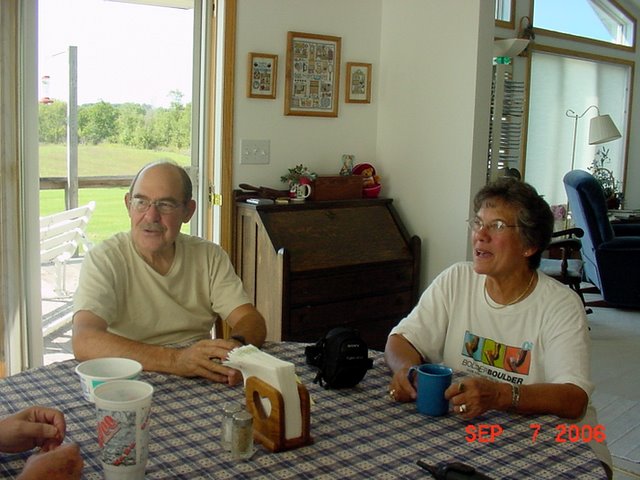
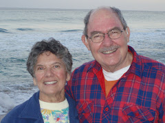
Dan and Madeline in Iowa, September, 2006

 Posted by Picasa

Ocober 6, 2006; Migration

It has been over two months since we have added to our blog!  Since I last wrote, Madeline went to Florida for a three-week sojourn to visit her son and his family, returned, and we started our annual migration east. I will try to give you a run-down on our life since my last writing.

While Madeline was in Florida, I moved the RV up to Estes Park for about 8 days, in order to spend a little time in the mountains. I took several beautiful hikes. Unfortunately my photographer, Madeline, was not there, so I don’t have pictures to share. One hike was up Boulder Creek. This hike was very steep and strenuous. The creek had numerous little water falls and cascades. The hike ended up on another trail so, I could follow it back to the road, where a bus returned me to my car on the road to Bear Lake. Another hike started at Bear Lake, went up a couple of miles to about 11,000 feet, where one could look down from a height, viewing Odessa Lake. This is part of the trail to Fern Lake which is the locale for the book, “Hard Truth”, by Nevada Barr. I was a little proud to be able to hike, albeit slowly, at 10,000 to 11,000 feet.

When Madeline returned, we started our journey east. We stopped in Iowa a couple of days and visited our friends, Tom and Liz. They are our friends, formerly from our Saint Louis. While there, we visited the Athens battlefield. This is a battlefield during the Civil War in what was once a town on the Des Moines River. The town has since disappeared, but several houses remain, maintained as a state park. The battle occurred early during the Civil War, and consisted of Home Guard units fighting --- two groups of guerrilla really – rather than regular army units. It is interesting to reflect on the violence in the Border States during the Civil War. Missouri, in particular was racked with fights, killings and acts of terrorism, which were many times undertaken by vigilante gangs. (In fact, Jessie James got his start with one of these gangs.) It was impossible for people to not take sides. Families that did not take sides would be terrorized, robbed, and likely killed. They had to choose a side, in order to gain protection from some group. The parallels between this and some of the activates in Iraq are obvious,

After Iowa we journeyed on to Van Wert, Ohio. We went there to attend the rally of Escapees, which is the name of our RV club. There were about 700 RV’s and about 1400 people attending the rally in the Van Wert fairgrounds. We volunteered to help, and were assigned to the team helping set up the parking area for the RV’s in the fields, and then assisting with parking on opening day. This was a lot of fun. Although it was ostensibly work, in truth, there was a lot of socializing, with pot luck dinners, visiting, and a social hour (drinks, snacks as well as socializing) every evening. The actual Escapee meeting was interesting, with seminars and booths by venders. Following the end of the meeting there was a day and a half work shop for computer users (Madeline attended) and genealogy buffs (Dan attended).

After the meetings we drove on toward Virginia. We spent a couple of interesting days in Harpers Ferry, West Virginia. Harpers Ferry is in that little corner of West Virginia, wedged in between Maryland and Virginia, where the Potomac and Shenandoah Rivers meet here. Thus Harpers Ferry is at one end of the Shenandoah Valley – a good agricultural valley west of the Blue Ridge Mountains. Although Harpers Ferry is just a small village now, with perhaps a population of three or four hundred people, in the early eighteen hundreds it was an important industrial center, because of the abundance of water power. It was a center of arms manufacture and consequently had a large armory.

Now Harpers Ferry is largely a National Historical Park. The town was devastated during the Civil War, changing hands a number of times as the Union and Confederate armies moved up and down the Shenandoah Valley. By the end of the war, the town was in bad shape, with many of the buildings burned, and most of the population gone. A series of floods petty much finished the job of ruining the city and its economy. The area was made a National Historic Site. In recent times many of the building of been rebuilt or renovated; so much of the town is a big museum, demonstrating how people lived in the early eighteen hundreds during the beginning of the Industrial Revolution.

Harpers Ferry was also the site were John Brown with a small group of men tried to occupy the city, in order to get rifles to start a war to free the slaves. I reflect on John Brown and wonder if he is to be admired as an idealistic though perhaps an ineffective abolitionist, or to despise him as a terrorist, with a history of planning and engaging in murderous terrorist attacks in Kansas. (Bleeding Kansas occurred when abolitionist and pro-slavery people tried to populate the Kansas. which was to choose or reject slavery by popular vote.) At any rate, John Brown became a martyr for the abolitionist. I was raised in New England and taught that John Brown was a hero to the cause of abolishing slavery. (I suppose we would call that cause human rights, today) Of course, many raised in South were taught to despise John Brown. Who is right? Where would we stand if those circumstances were to occur today?

Following our visit to Harpers Ferry we moved down to the Richmond area to visit our son and his family. We are having a good time. We will be moving on South soon. Our next stop will be to South Carolina and then on to Alabama to get work done on our rig.

Sunday, August 06, 2006

Aug 6, 2006 A week at Rocky Mountain National Park

Below are a couple of pictures Madeline took. One is a picture of the sun rising and the first light on the mountains. The mountain in the picture is Longs Peak, the highest mountain around here – over 14,000 feet. People (stronger hikers than me, for sure) get up at 3:00 in the morning and hike up there, hopefully to arrive and leave before the afternoon thunderstorms come up.

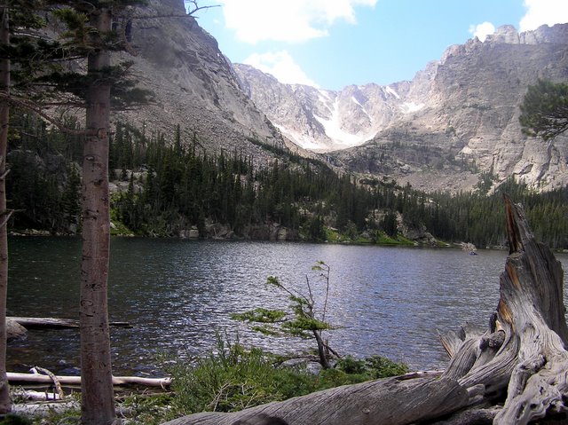
The other picture is of the Loch. The Loch is a beautiful mountain lake at the end of a three-mile hike. There are several hikes that end at these mountain lakes.

Tomorrow we will take one last long hike, and then return to Lyons, where I will camp, and Madeline will visit Florida.

The Rockies

Sun rising upon Longs Peak

The Loch, a mountain lake at the end of a thre mile hike
 Posted by Picasa

Monday, July 31, 2006

July 31, 2006 A Week in the Mountains

We spent the last week in the San Juan Mountains, north of Pagosa Springs, on the west side of the Divide. We were camping on National Forest Campgrounds. One of the campgrounds had full hookups, so we stayed there a few days, and then moved up to the reservoir. I did a little fishing and caught all the fish we cared to eat! One rainbow trout was over 15 inches long, and was more than Madeline and I could eat in one stting.

This area is one in which I camped with my family over 40 years ago. I wondered if it had changed much and was pleased to discover it was still as wild and unspoiled as ever. I wonder if my children remeber camping there. It was our first camping vacation in Colorado.

The muntains there consist of layers of lava which are some times level and sometimes tilted. This makes for very striking mountains with many big square blocks -- sometimes building pyramids -- sometimes making structures resembling castles and walled cities, and many other delightful structures. One evening, as we watched the sunset, Madeline and I fashioned names based on what the mountain reminded us of.

Sunday, July 30, 2006

Sunset at Dinosaur Mountain

 Posted by Picasa

San Juan Mountains, North of Pagosa Springs

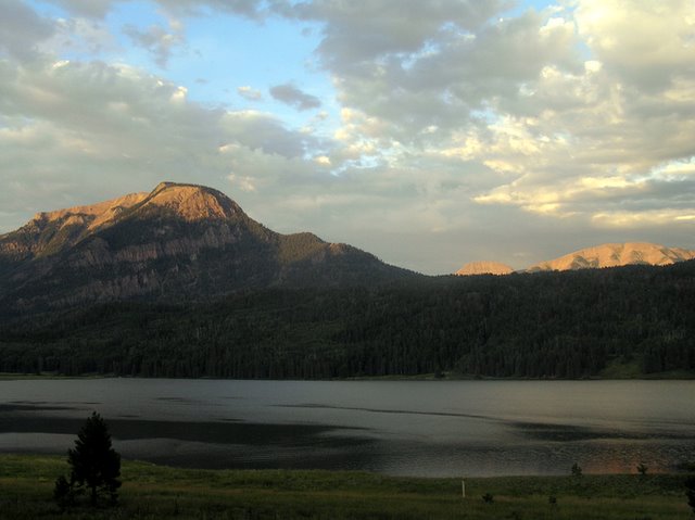
Sunset at Williams Reservoir. We nicknamed the mountian in the background, Tyrannosaur
Mountain. The two beds of lava rock serve as teeth!

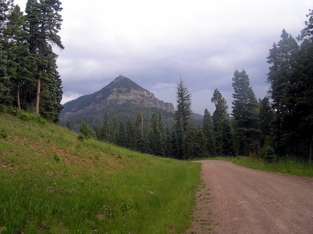
The mountain behind the road, we called Pyramid Mountain. This is fairly typical one of the San Juan Mountains in this area. The mountains are composed of layers of lava rock that has gradually eroded. Some mountains, such as this one, have a little cap of lava on the top.

Posted by Picasa

Thursday, July 20, 2006

July 20, 2006 Escapees and Traveling On

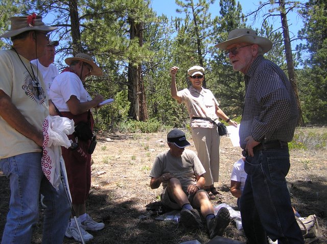
We arrived in Hatch, Utah to attend a rally of our Escapees RV Club. There were about 50 units there. The main activity was driving on the back roads on either 4-wheel drive vehicles or ATV’s. Madeline and I took our little Tracker on several trips. We also led a group on a geocaching trip. There are many, many geocaches in the Hatch area. It was fun to meet old friends again and participate in group activities. There was lots of good food and good company

A high spot on the trip was a weekend visit by our daughter Diana. She spent one day 4-wheeling with us, and another day visiting Bryce Canyon.

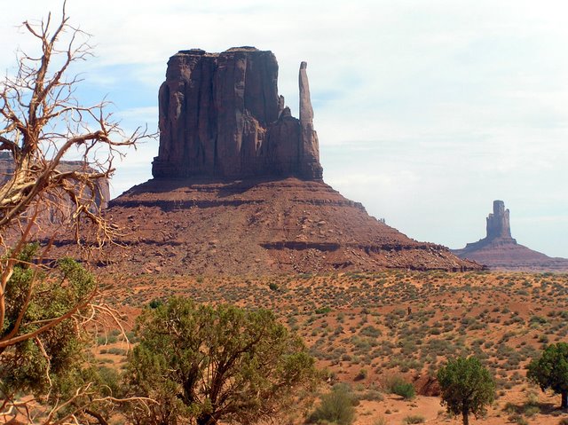
We left Hatch and are headed east. We revisited Monument Valley, and are now in Pagosa Springs. We may stay here a few days and journey up into the San Juan Mountains. Or perhaps we will move over the other side of the divide to South Fork.
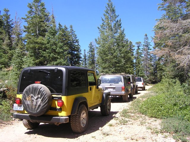
1. Four Wheeling with the Escapees

2. Geocaching with our Escapee Freinds

3. Mounument Valley

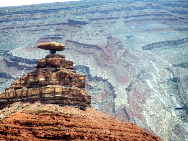
4. The Mexican Hat at Mexican Hat, Utah


Posted by Picasa

Tuesday, July 11, 2006

July 10, 2006 - South Pass and the Oregon, Mormon and California Trails

Last week we moved on from Lander, Wyoming on down to Fort Bridger, Wyoming and eventually to Hatch, Utah. This trip took us up over South Pass, the point where many pioneers passed over the continental divide.

South Pass, although at respectable elevation, (7550 feet), is actually a fairly flat, high plateau -- treeless, and wind swept. Pioneer travelers had to leave the Sweetwater River and make what hopefully would be quick trip to the Big Sandy River. Many of the pioneers opted to take a short-cut, the Sublette Cutoff, a shortcut taken to reduce to time to get to Oregon, but chancy -- requiring 50 miles without water -- meaning it was necessary to carry sufficient water for oneself, and livestock, and to not getting lost. Death or at least loss of all possessions could and did happen. The short cut was taken to save time. The pioneers were anxious to cross the mountains to Oregon before winter set in.

Other hardships occurred on the Mormon Trail. Many of the Mormon pioneers, -- some of them immigrants from Europe, would pack all their possessions in two wheeled carts and pull these carts all the way to Salt Lake City. On several occasions pioneer Mormons got trapped in bad weather, and were rescued by earlier settlers form Salt Lake City.

Enormous numbers of Americans emigrated west in the 1800’s on the Oregon, Mormon and California trail. In fact the Western states were all settled by immigrants, many of them traveling under extremely dangerous circumstances. Many died. At South Pass and Fort Bridger, places now nearly deserted, were once the site of many people passing to new homes.

We need to remember we are a nation of immigrants, who have largely displaced the Native Americans, the original inhabitants. This should give us pause when we see today, when we see people who in very dangerous circumstance come to our country seeking an opportunity for a better life, much as were those who passing through South Pass and Fort Bridger, less than a hundred years ago.

Thursday, July 06, 2006

July 6, 2006; Lander, WY

We have spent the last week, which included the Forth of July holiday, at Lander, Wyoming. Lander is a small town of about 6,000 people, located on the east side of the Wind River Mountains. It is about 60 miles west of Jeffery City - where I am told “Home on the Range” was written, about 40 miles northeast of South Pass - the historic pass where the Oregon Trail, Mormon Trail and California Trail crossed the continental divide, and 20 mile southwest of the Wind River Indian Reservation - home of the Shoshone and Arapaho Indian tribes.

Lander is a delightful small town. Wal-Mart and Home Depot have not arrived, so the town boasts several hardware and auto-part stores, two grocery stores, numerous small clothing stores, and a wonderful bookstore with a wonderful selection of soft covered books such as “Hours”, and “A Short History of Tractors in the Ukrainian”. (I just finished the latter novel, enjoyed and recommend it!). A newspaper is published in Lander, every Wednesday and Sunday. One can get the New York Times, sometimes. It comes in on the afternoon airplane, usually – but not always. If the Sunday edition does make it in on Sunday, you can probably get it on Monday and for sure on Tuesday. Lander is a very nice Western town that reminds me a lot of the way towns used to be decades ago. The pace is relaxed, and people are very friendly.

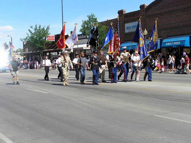
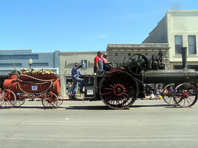
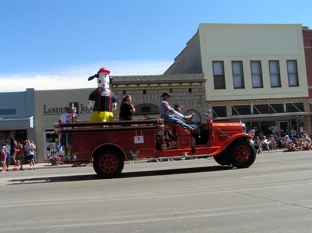
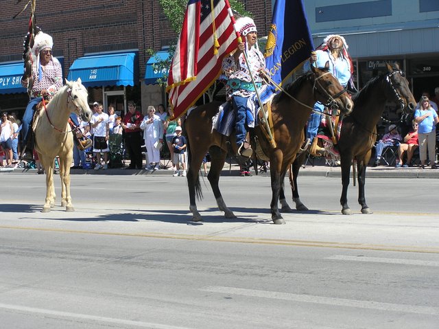
The Forth of July celebration was noteworthy. The mainstay of the celebration was a three-day rodeo with bull and bronco riding only on Sunday night. On the forth there was a parade. It had many of the things we often used to see in parades. The Legion marched and the high school band marched by There were Indians (real Indians) all dressed up in feathers, carrying a coup stick (I think) and of course an American flag. Then, as you would expect in the West --- Lots of people on horses – old people, young people, dressed-up people, authentic cowboys all dressed up with western hats and chaps, and three generations of one family, proudly riding bareback. An array of political candidates running for sheriff, state senator, councilman, etc drove by in trucks or convertibles. Finally there was an array of different types of vehicles, including Model A’s, old fire trucks, Cadillacs and Chevys from the fifties, and one iron-wheeled steam tractor using wood for fuel..

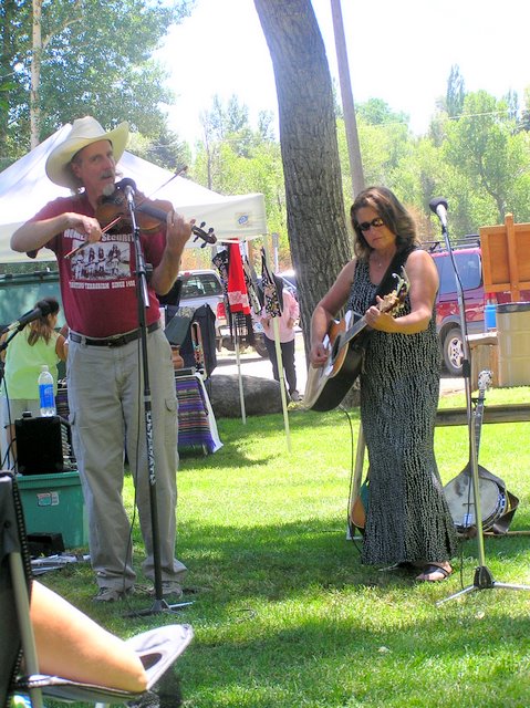
After the parade, we went to the city Park and enjoyed a barbeque of buffalo brats, beans and potato salad. There were a couple of musicians playing and singing folk and country songs. One of the musicians played a mean country fiddle, which reminded me of the terrific fiddlers we used to hear at square dances in New Hampshire when I was a teen.

That evening the end of the holiday was celebrated with fire works set off at the rodeo. We got a wonderful view of the fireworks from our RV. (The rodeo park was just over the hill.)

American Legion on Prade, July 4 in Lander

  Posted by Picasa

Forth of July in Lander, WY


Fiddling at the Park

Bio-fuel -- run by wood!
Old Fire Truck
Posted by Picasa
Very proud narive Americans, with flags and coup stick (I think it is)

Saturday, July 01, 2006

On and About the Bighorn Mountains

We left Colorado in route to Wyoming and the Bighorn Mountains. Our first stop was at Kaycee, Wyoming. After passing the Hole in Wall Bar, Butch Cassidy Motel, etc., we asked if the Hole in Wall, site of the one-time headquarters of Butch Cassidy and the Sundance Kid was actually nearby. The answer was, yes, it was a place easy to get to.

I have been trying any number of years to visit the Hole in the Wall, to see where Butch Cassidy and his pals hung out. The first time I attempted it was years ago, but what with obvious four-wheel drive roads, and my Oldsmobile compact car, it was obvious that I was driving into an untenable situation.

This year, we now had four-wheel drive, high clearance, and lots of time, it seemed an opportunity to try again. It turns out, it is not an easy task to visit the Hole-in-the-Wall. Although everyone in the Kaycee area is very proud that this is Butch Cassidy country, and nearly every other motel, bar, or restaurant is either has Hole-in-the-Wall or Butch Cassidy in the name, actually few people can give you accurate directions how to get
there.

The first day we set out, with what we thought were clear directions. After driving about 30 miles on dirt road, we took a right on a road to "Hole in-the Wall' Campground. Well, after driving several miles on dirt roads, we found no campground and no Hole-in the-Wall. We finally drove by a rancher's wife getting mail from her mailbox. After inquiring we found that we were on the way to the Dull Knife Battlefield, but Hole-in the Wall was the other direction.

We reversed our way, and followed new directions. Our road passed through private property, with lots of warning sides to stay on the road. . The road deteriorated to a track, demanding four-wheel drive. We drove up the side of a mountain, avoiding deep ruts and high stones in the road. We eventually found a sign to the "Outlaw Cave". We got out and walked about, and finally peered down to the bottom of a canyon, where we could see a steep trail leading to a series of shallow caves. The Outlaw Cave - probably; ---- Butch Cassidy's Hole-in-the-Wall -certainly not. We drove about a bit, saw some
badly vandalized Indian pictographs in a shallow overhang, and started to return home. As we went down the mountain, we looked across the valley, where there was a long red cliff, extending some miles, both north and south. Thus we concluded was the Red Wall, where the Hole-in-the-Wall might be found. However, there was no public road or any other obvious to get to the Red Wall to search for Hole-in-the-Wall. By this time it became obvious that the location of the site in the atlas was in error.

Back to camp, we returned for further inquiries to get new directions. The new directions were that Hole in the Wall, could only be reached by an entirely different series of roads, which would entail a 40 to 50-mile trip (one-way), most of it on dirt road, with about 15 miles requiring a high clearance vehicle, 4-wheel drive, and not under any conditions to be attempted after a rain (would get stuck in the mud). Furthermore, we were told, once we reached our destination by car, a 3-mile one-way hike would be required to get us to the
Hole-in-the-Wall. Being adventurous, Madeline and I decided to attempt the trip.

Sure enough, there was a long trip over prairie, hills, grassland, rocks, ledges and desert. Finally we reached the end of the road. There was a trail, which we assumed would lead us to our destination. We hiked up hills, over very dry grassland, and over some dirt roads. (Why we wondered, could we not drive down those roads?) Finally after about three miles, we approached a point where two red cliffs of the Red Wall joined in a bundle of rocks. At this point the trail petered out. This, as we discovered later was the Hole-in-the wall. At the time, Madeline was not convinced, so did not climb up on the rocks. I was positive this was the place, so I started climbing. However, my sense of balance has diminished to such a point, that I finally decided I had gone about as far as I safely could. There is an attached picture showing how far I got. However, the “trail” is much steeper than appears in the picture. We decided, we had probably done enough and began our journey home.

After we had gotten about a quarter of a mile away, the most astonishing thing happened. Buses and trucks went down the dirt road we had walked along, and drove to a parking lot and dislodged a huge group of people. Most of them just stood around, but perhaps 20 people then hiked to the Hole-in-the Wall, and climbed (rather nimbly, I am afraid) up the cliffs and rocks, I had attempted, to the top of the wall, and I suppose went on to see, what is said to be, a lush valley behind the Red Rock Wall. Later we concluded that
the dirt road was a private ranch road, which allows periodic guided tours in to view the Hole-in-the-Wall.

I suppose there must be other ways to get into the valley behind the Red Wall. From what I have read since our visit, I gather the location of the Hole-in-the -Wall, was fairly well know in Butch Cassidy's time and before. It was known as an outlaw hangout, and there were occasional gunfights and murders in the area. I can see how a horse trail could be carved out of the jumble of rocks, but I dont see how a horse could get up through it today, nor can I see how a herd of stolen cattle could be taken up through there.

Anyway, I have seen the Hole-in-the Wall, but did not quite make it through
the Hole to the other side.

While on our road trips in the Kaycee area we saw many, many pronged horned antelope grazing along the side of the road. In fact while driving, one had to keep close watch to be sure they did not dart out in front of the car (or RV on the Interstate). We also saw quite a few horses on open range. On Friday night we went to a local rodeo in Kaycee. It seemed to be a rather local affair, and I think many of the cowboys and cowgirls were trying to get experience, as many of the calves and steers did not get roped at all. There were special event for kids, which involved tying a handkerchief on the tail of a goat (for the youngest or throwing and tying a goat (slightly older kids0. it was a lot of fun.

We have continued our trip to the Bighorn Mountains. We are now at about 8,000 feet, and it is quite chilly at night and in the early morning. We are doing some hiking --- perhaps the most interesting so fat up Black Mountain to a Fire Station that is no longer manned. The flowers are in bloom, with the floor of the forest and the fields pretty much covered with purple lupines, and lots of other flowers too. Madeline’s favorite is the intensely blue forget-me-nots.

Yesterday, we drove down the west side of the mountain on a day trip to Bighorn Canyon. The canyon has largely filled with water, due to a dam on the north side of what now is a lake. The area about the canyon is quite dry and rocky. The high point of the trip was seeing big horn sheep. We saw mothers with their young. We understand the maless are all up in the mountains now. We were very excited to see the bighorns, as we have been trying to see them in the wild for several years!